The Santa Ana Winds Do Not Start Hot. What Happens Before They Reach Los Angeles Is the Dangerous Part

LOS ANGELES: A Santa Ana wind can arrive like a switch has been thrown. The ocean breeze disappears, humidity collapses and air begins racing toward the coast from the northeast. The result feels hot, but the wind does not simply blow out of a scorching desert and carry that heat unchanged into Los Angeles. Its most important transformation happens while it descends from higher inland terrain toward sea level.
The setup begins with higher atmospheric pressure over the Great Basin and lower pressure closer to the Southern California coast. Air moves from high pressure toward low pressure, sending it west and southwest across mountains and through passes. That direction is the reverse of the region’s usual onshore flow, which brings cooler, moister Pacific air inland. A Santa Ana event replaces the marine influence with continental air.

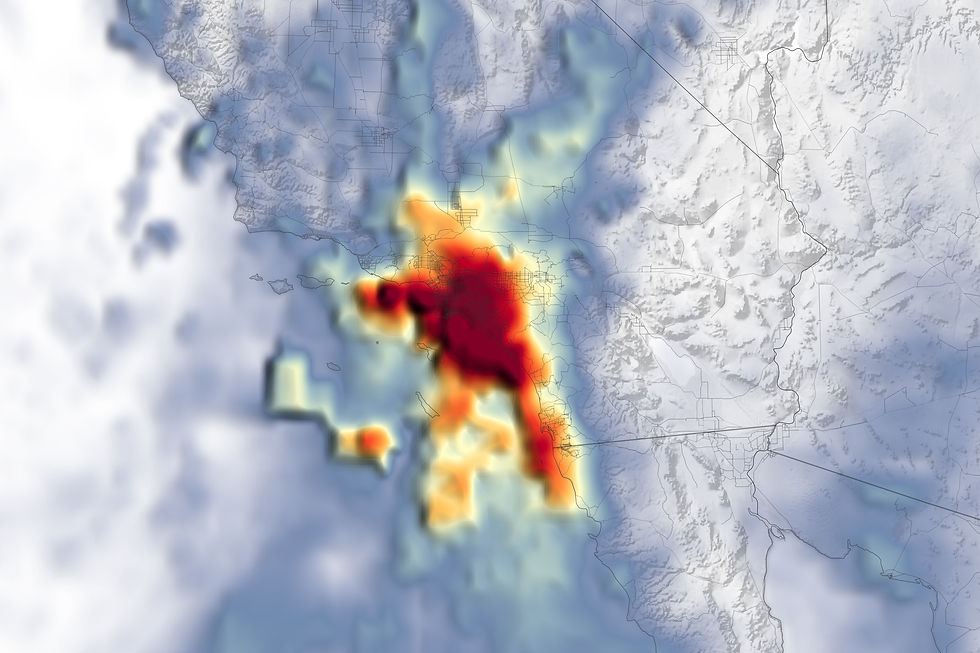
Powerful Santa Ana winds can turn a spark into a fast-moving regional emergency. Image: NASA Earth Observatory / Public domain
As the air descends, the pressure around it increases. Compressing air raises its temperature even without adding heat from the ground, a process meteorologists call adiabatic compression. Warmer air can hold more water vapor, so its relative humidity falls sharply. By the time the flow reaches the Los Angeles Basin, the same air mass can be warmer, drier and moving much faster than it was inland.
Mountains make the speed uneven. Passes and canyons can funnel the flow, much as water accelerates through a narrow channel. One neighborhood may be gusty while another nearby location is calmer. Ridges, slopes and gaps also create turbulence. A regional forecast therefore cannot describe every block, and the strongest winds do not always occur where the temperature is highest.
Not every Santa Ana is hot. Research led by Southern California climate scientists distinguishes hot and cold versions of the wind. Cold events can produce some of the strongest gusts, while hot events tend to be drier and last longer. The name describes the offshore wind pattern, not one guaranteed temperature. What the versions share is low humidity and a flow that can dry vegetation quickly.
That drying power is what turns the winds into a fire problem. Live plants, dead brush and wooden structures lose moisture when exposed to very dry air. If an ignition occurs, wind supplies oxygen, bends flames toward new fuel and carries embers well ahead of the main fire. A fallen line, equipment spark or other small ignition can become difficult to contain before crews have time to build a perimeter.
Wind also complicates evacuation. Smoke can move away from the flame front, visibility can change rapidly and falling trees may close roads. Residents should treat official warnings as decisions about time, not predictions about whether a particular house will burn. Preparing medication, documents, pet supplies and a charged phone before an alert leaves more attention for the route when conditions change.
The air can affect people even without a fire. Very low humidity dries eyes, skin and airways. Blowing dust and displaced pollution can worsen respiratory symptoms. Outdoor flames, unsecured objects and driving near high-profile vehicles become riskier. Utilities may reduce power in selected areas when equipment faces extreme wind and fire conditions, so backup lighting and a way to receive alerts matter.
Climate change does not produce a simple promise of more Santa Ana winds. Studies suggest the seasonal frequency may shift, especially in fall, while hotter and drier fuels can still worsen the consequences when severe wind and fire weather overlap. The useful lesson is narrower: wind is only one part of risk. Vegetation dryness, development, ignition sources and emergency readiness determine how destructive an event becomes.
Los Angeles cannot stop the pressure gradient or flatten the mountains. It can reduce the chance that the wind finds a spark and improve how quickly people respond. The next time the palms bend toward the ocean and the air suddenly feels brittle, remember what is happening overhead. The danger is not a mysterious hot breath from the desert. It is ordinary physics moving through an extraordinary landscape.


Comments